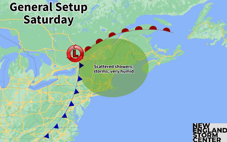
New England is back into the warm sector of a frontal system today. This will lead to very humid conditions along with seemingly random hit and miss storms throughout the day. A cold front will remain to New England's west today before slowly pushing toward the coast for Sunday.

The seemingly random nature of the scattered storms comes down to the fact that the atmosphere is very moisture-rich with tropical-like dew points into the 70s (and well into the 70s for some). Combine this with the generally unstable atmosphere within the warm sector of a system, it won't take much for storms and downpours to develop around the region. With that said, the system over New England is rather weak, so forcing for storms is weak and generally lacking.
These two opposing forces have created a low confidence forecast where models have little to no run to run consistency, with both themselves and other mesoscale models. This is why it's best to say scattered thunderstorms will be all around New England throughout the day, but nowhere will it be raining all day. A wave of more widespread showers and storms will move through New England this morning.
Radar as of 8:15am:

A big question for this afternoon will be how this morning wave of activity will impact the development of storms later in the day. After this wave, some breaks of sun will be possible, especially across western New England. This will help to destabilize the atmosphere once again after this morning line uses some of the energy. The farther west you go, the better the chance of seeing multiple waves of storms.
After a likely break in the action around midday to early this afternoon, storms will likely begin to fire back up across western New England and track generally northeast. These storms could get on the stronger side, but most storms should remain below the severe threshold. The bigger threat will be torrential rainfall and isolated flash flooding.

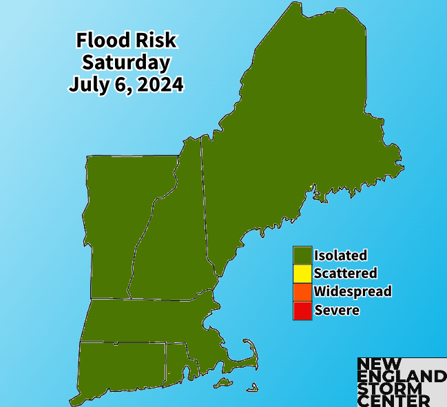
In this environment, it won't take much for any storm to produce heavy rainfall. This has already occurred this morning with the morning wave. Additional bursts of heavy rain later today may lead to instances of street ponding and flash flooding.
These issues will be localized rather than widespread with the scattered, random nature of storm placement today. While storms should be progressive and move along at a decent clip, training (when multiple storms move over the same area) is possible. If this occurs, there will be flooding issues where it sets up.
As for the ingredients for severe weather, moisture will be abundant, but shear, lift and instability are bigger questions. Some mesoscale guidance has most unstable CAPE values well over 2,000 along with effective shear for storms to strengthen. Should this come to fruition, storms will be able to become stronger with strong winds being the biggest threat.
HRRR surface-based CAPE values this afternoon. You can see heightened instability across interior southern New England:

This would most likely occur in southern New England, particularly well away from the coast. Lift will be weak today with a weak cold front remaining to the west of the region. Again, the severe threat is low overall and most storms won't be able to become severe as the setup just isn't too favorable for it.
Storms chances will eventually taper off after sunset. The weak cold front will push through New England and possibly stall near the coastline for Sunday. The weak nature of the front will allow temperatures to climb once again and with more sunshine possible in the afternoon, it will likely end up warmer than Saturday.

The front will be able to knock humidity down from the tropical-like levels on Saturday, but it's not strong enough to completely erase it. Dew points will remain in the 60s for most with 70s staying in place near the south coast. Humidity levels will generally remain around what you’d expect in July into next week.

Temperatures will remain very warm through early next week as high pressure to the south continues to pump hot, humid air into the region. A subtle heat wave will be possible Sunday through Tuesday in parts of southern and central New England, particularly away from the coast. Feels-like temperatures could reach well into the 90s. An approaching system on Tuesday may bring showers and storms to western New England before all of New England sees elevated activity by midweek.
Comments