After a nice break from rainy weather, another system is approaching New England. This storm, while not looking as potent as some of our previous systems, will have the chance to produce strong thunderstorms and heavy downpours at the end of this week.
THURSDAY
The area of high pressure in southern New England that has been the dominant weather feature for New England over the past few days will slide offshore of Cape Cod. This will allow the wind direction to switch from the pleasant northwest wind that we've had back to a southerly wind. This will, in turn, bring higher humidity back into the region from the south.
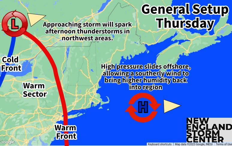
Thursday will be dry for most of New England on Thursday as the storm system continues its approach. Northern Vermont and New Hampshire will likely see some scattered storms break out in the afternoon. These storms will grow in numbers and intensity as the afternoon progresses into the evening.
Overnight Thursday night, storms and downpours are looking to ramp across Vermont and northern New Hampshire as the system continues its push eastward. There is currently a small chance of some storms turning strong to severe across northern Vermont Thursday night. It's difficult to get potent thunderstorms at night in New England, but there's some ingredients coming together that could allow it. Again, it's a small chance right now, but we'll need to watch trends as today and tomorrow goes on to see if the threat increases.
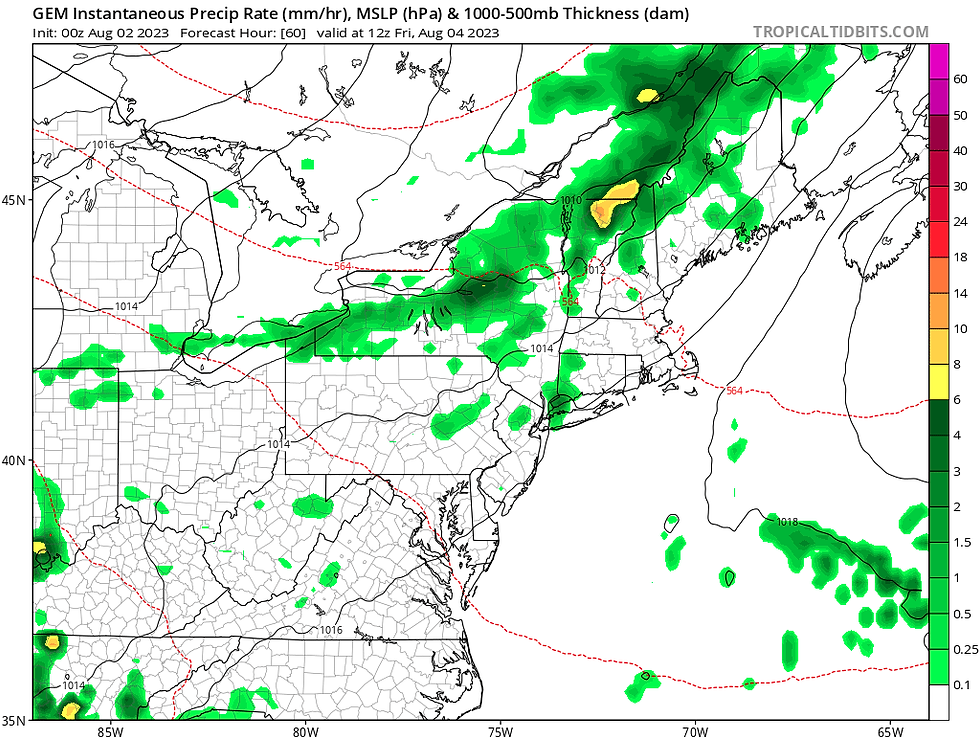
Canadian model showing where storms may break out overnight Thursday into early Friday morning:
FRIDAY
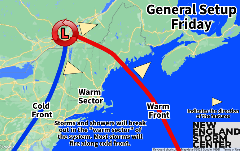
The warm front associated with the system to our north cross the region. This will ramp up the amount of moisture in the atmosphere and allow for increased clouds and perhaps morning showers. This increased cloud cover will do two things for Friday: limit temperatures to the low to mid 70s and limit the amount of instability for afternoon thunderstorms to be able to become potent.
With this limitation on the strength of thunderstorms, an outbreak of severe weather is not expected. It is worth noting that the Storm Prediction Center has southern Vermont and Western Massachusetts in the "marginal" category for severe storms, meaning a couple storms could get strong. Generally, thunderstorms will be run-of-the-mill.
With dew points approaching 70 degrees for much of New England Friday, there will be plenty of moisture for storms to work with. The biggest threat in these storms will be torrential downpours. While the setup isn't as conducive for the type of rainfall we've seen from storms in July, there will be enough moisture in the atmosphere to produce localized heavy rain in storms leading to isolated flooding issues. Pretty much all of New England will have a chance to see heavy downpours Friday.
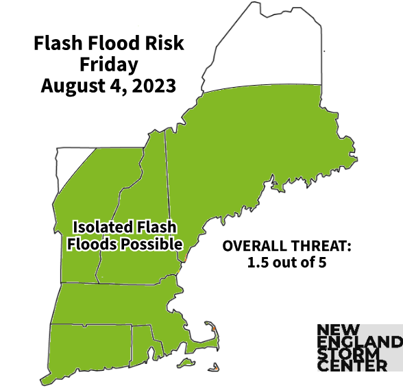
There could be a widespread half an inch to an inch of rain across New England with locally higher amounts in areas that get stuck under a torrential downpour or two. Right now, it looks like southern New England will have the greater chance to see localized issues and the highest rainfall amounts. Southern New England's threat may increase over the next 12 hours, this will be something to watch.
While showers and storms will possible all day as New England will be in the "warm sector" of the system, the storms will generally become more widespread, the most storms firing up in the afternoon and evening as the cold front crosses the region. The exception may be northern Vermont. Depending on what exactly happens with storms on Thursday night, that area may see more limited activity on Friday. This is why the Champlain Valley is left out of the "isolated flash floods possible" area on the map above for Friday.
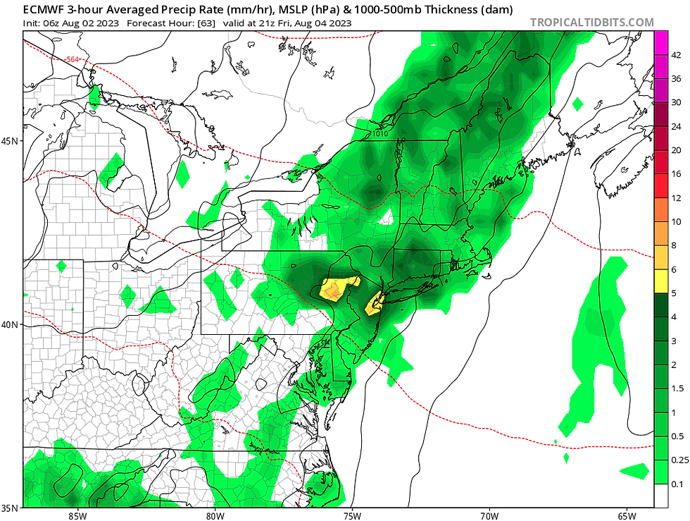
Euro model showing widespread showers and storms early Friday evening. It likely won't be raining everywhere in the green all the time, but storms will be most widespread at this time:
WEEKEND
Previously, we mentioned that a weather pattern change allowed storms to speed up and move through New England quickly instead of stalling out around the region. This storm will be no exception. The system looks to move quickly through the region and exit eastern Maine by Saturday morning. Saturday is looking dry with at least partial sunshine for most. The exception will be eastern Maine, who will likely see some lingering showers and storms in the morning, but even these areas will likely see partly cloudy skies by afternoon.
High pressure builds back in behind the cold front for the weekend, leading to another very nice Sunday.
Kommentare