It was coming, it always does. At some point during the month of April, just about every year, a frontal boundary stalls over New England. It took until the last week of April for it to happen in 2023, but it's here now. Stalled frontal boundaries often steal nice, sunny weather from New England.
A stalled frontal boundary is basically a front that has been blocked from moving out of the area. In many cases in New England, this block is an area of high pressure keeping the front from clearing out. This is naturally called a "blocking pattern". In this case, New England, and the entire east coast, is stuck in an "omega block", so named because isobars typically resemble the omega symbol.
Sometimes these boundaries can taunt New England, keeping sunny, warm weather just south of the region. While Pennsylvania, New Jersey and sometimes even New York can bask in 70s and sunshine, New England is stuck in the 40s with lots of clouds and showers. That's not the case this time around as much of the northern tier and east coast of the United States will be cool this week due to the aforementioned block.
Weather maps for April 24 and 25, 2023. You can see the stalled front and low pressure right over New England:
Nonetheless, this stalled frontal boundary, combined with the omega block, will keep New England cool, cloudy and showery for much of this week. It won't be totally cloudy all week across the region, but there will be much more clouds than sun. It won't be well below average temperature wise this week, just slightly below this week. It may seem well below as the April we've had has been rather warm and sunny, but that wasn't normal for New England. What we're seeing this week is much more "normal" for this time of year.
A classic "symptom" of a stalled frontal boundary is a nearly constant threat of showers. This is because these boundaries steer every single little disturbance right through New England. While there won't be any more washouts this week, scattered, light showers will hang New England all week. Northern New England will see a higher chance of showers Monday afternoon while southern New England will see more showers Tuesday.
This pattern of mostly clouds and scattered showers will continue through much of the week. As with all blocking patterns, the only way we're getting out of this kind of weather is for the block to break down. There are signs of that happening at the end of this week, with a gradual warming trend by Friday.
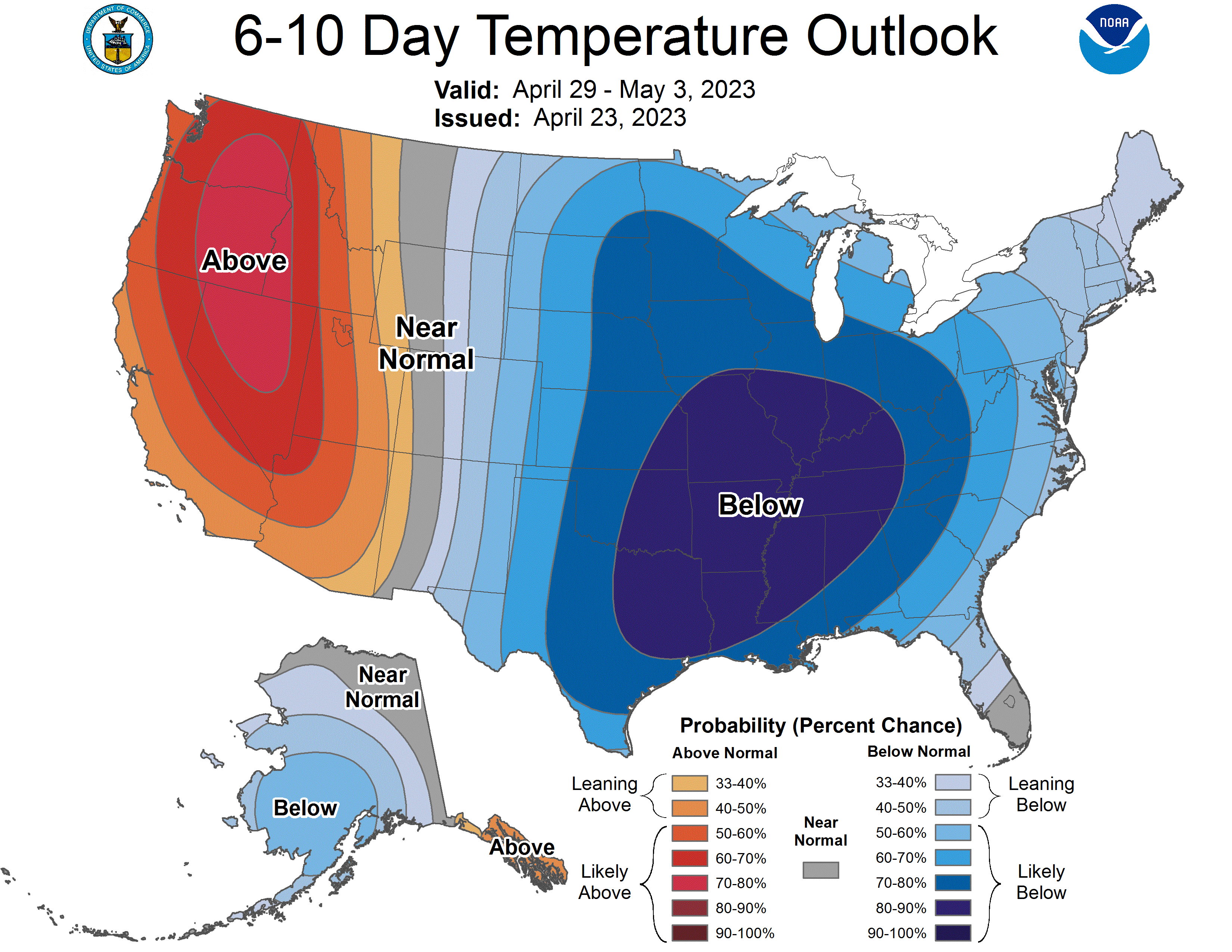
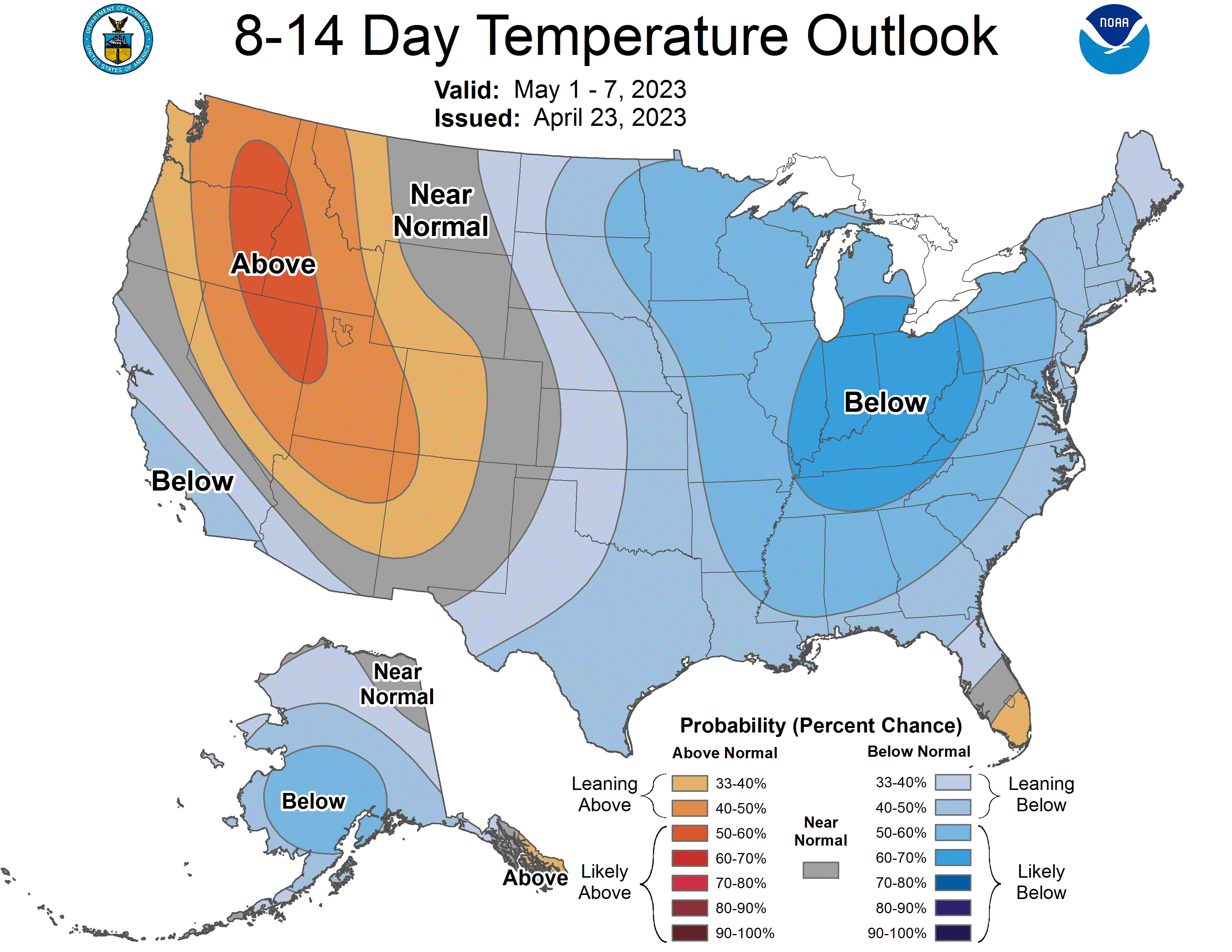
This breakdown is currently looking to be short lived, as another rain storm is currently looking to impact the region on Sunday. A new omega block may set up for next week, providing at least one more week like this one. That's the thing with these patterns, they seem to hold on for dear life, refusing to let go. This can lead to weeks of this kind of weather. The NOAA's 6-10 day and 8-14 day outlooks are favoring cooler than average weather persisting through at least the first week of May.


Yorumlar