Spring-Like Pattern Sets up Before Next System Arrives Thursday Night
- Tim Dennis
- Mar 18
- 3 min read
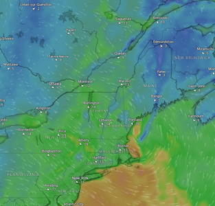
Despite the passage of yesterday's cold front, it won't turn all that cooler behind it. A narrow ridge of high pressure will build into New England. This won't be a cool, Canadian high pressure, so temperatures will remain elevated. With that said, flow will be weaker under the high pressure, which will allow for an easterly flow to develop. An easterly flow in mid-March will ensure the coastal plain cools off through the afternoon while areas west and north remain milder.
The onshore flow may also promote stubborn clouds along the coast as well while western areas see more sunshine each day; a very typical spring setup. This setup will be seen numerous more times over the next couple months (it'll hit harder in mid and late April when western areas climb toward 80° and the coastal plain struggles out of the low 50s).
Below: Temperature departure from average Wednesday evening:

Several rivers reached minor flood stage yesterday. Most of these rivers have now crested and are receding. The Connecticut River may take a bit longer to crest today in southern New England, but only minor flooding remains forecast. The potential for ice jam flooding will remain elevated across northern New England over the next few days as ice continues to rot in these mild conditions.
Below: River forecasts as of Tuesday morning:

The next system looks to enter the picture next Thursday into Friday. A primary looks to move well north of New England with a secondary low forming near the Mid-Atlantic. This storm currently doesn't look as moisture-packed as the storm exiting now. The main area to watch will be the potential secondary low development in regards to strength, track and timing. This will determine the level of potential wintry impacts in New England (along with where these impacts would occur).

As the primary low pressure tracks to the north of New England later Thursday, it will initially allow for a more southerly flow and warm air advection, allowing for rainfall. Once the secondary area of low pressure forms to the south of New England and travels northeast near the region, it will cutoff the feed of mild air and allow a switch to a more northwesterly flow. This will allow for colder air to drain into the region later Thursday night and into Friday.
Below: Euro showing forecast wind direction and speed Thursday afternoon (1st image) and Friday afternoon (2nd image):
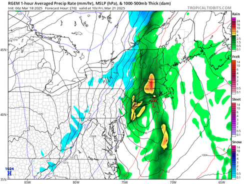
This setup should allow for rainfall for everyone initially as the system moves into the region. By Thursday night and into Friday, a sharp thermal gradient may set up along the system's cold front as the secondary low cools the atmosphere. This is poised to allow for a transition to snowfall from west to east and higher elevations to lower elevations. This swap to snow will likely occur on the western edge of the storm.
One of the bigger uncertainties is how close to the coast this transition gets before precipitation begins to wind down as the storm pulls away. The coastal plain will naturally take the longest to cool down (compared to the higher elevations farther west and north). Precipitation may shut off before it cools enough.
For western New England and all the higher elevations, the question will be how quickly does the secondary low develop and strengthen. A quickly deepening storm will be needed to switch rain to snow given the mild temperatures and the initial southerly flow. Should the secondary low take time to develop and strengthen, rain will rule for everyone. The storm will need to rely on dynamical cooling of the atmosphere seeing as how the transition to snow would occur during the day, when temperatures normally begin to warm.
Below: RGEM showing potential weather around sunrise Friday (1st image) and early Friday afternoon (2nd image):
Currently, the precipitation forecast shows 0.25-0.75" across the region. With that said, precipitation forecasts this winter have had a tendency to rise at the last minute, so that will be watched, especially as precipitable water values appear to be elevated Thursday night. The cold front that all of this will be happening along will be slow-moving and it will slow down further once the secondary low develops.
This doesn't look like an overly impactful storm in regards to both snowfall and rainfall. At this point, minor accumulations of snow appear possible, especially in the higher terrain (Greens, Whites, Maine mountains, Berkshires and maybe Worcester Hills). As dynamical cooling takes effect, it may allow for a brief period of heavier snowfall rates within a narrow band. As of now, this appears most likely to set up over eastern Vermont and western New Hampshire. Trends regarding that will be something to watch.
Below: Current probability of minor winter weather impacts through Friday:


Comentários