The final countdown to the 2024 total solar eclipse is underway for New England. The prospects for the weather on April 8th have been pretty good throughout the week. In fact, New England has had some of the best prospects in the country.
With that said, there have been two weather features we've been watching all week that may prevent a completely sunny day. Here are how things are currently looking. We'll keep watching the trends, especially as we start getting into high resolution territory.
MAIN WEATHER FEATURES
The first feature of the two is a system to New England's west. This system will pull a warm front toward the northeast in the afternoon. Some high clouds may increase across western areas through the afternoon from this feature. This is something to pay attention to across the path of totality in Vermont, particularly western Vermont. This may filter the eclipse, but not completely block it from view.
Canadian model showing cloud fraction at 3pm on Monday:

The other feature is a backdoor cold front looking to drop into New England. This front has been shown on guidance all week dropping into northern Maine first before progressing southwest. The overall timing of this front has slowed down through the week, with most areas seeing the front crossing more toward Monday night. Like the western system, this front could produce some high clouds, especially for northern and eastern Maine.
The moisture in the atmosphere will be very low, with PWAT (precipitable water) values dropping to around 0.25". This indicates a very dry air mass. This will make it difficult for any low or mid-level clouds to develop.
Winds will be out of the west/northwest. Normally, this wind direction could cause an increase in cloud cover, but the air mass is so dry, it will, again, be hard for many clouds to develop from this alone. Low-level upslope flow across the mountains would usually create more clouds for the mountains, but the air mass is so dry, this may not be the case. Winds may become a bit gusty, especially for northern and eastern Maine, in the afternoon
Overall, skies are expected to be mostly sunny in the afternoon. A 100% sunny day is likely just out of reach, but it certainly won't be overcast, or close to it. Much of the northern tier of New England has a deep snowpack after recent storms. This will still be present on Monday with melting conditions. This will likely lead to muddy areas and roads.
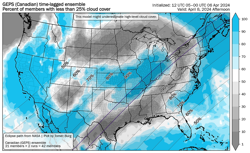
Canadian model showing chances for 25% or less cloud cover Monday afternoon. The GFS and Euro generally agree:
POTENTIAL CLOUD TYPE
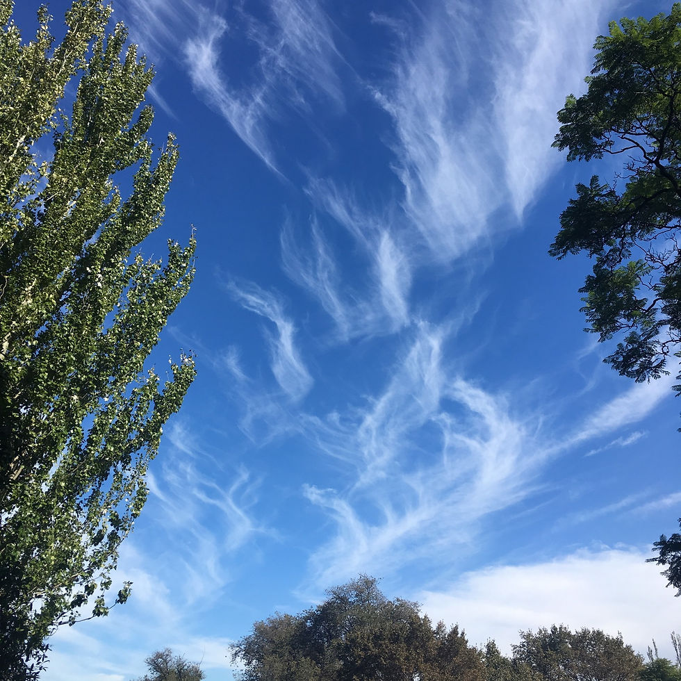
Both of the above features are more likely to create the high cloud type known as cirrus. IF clouds must enter during the eclipse, this is the best kind to do so. Cirrus clouds are thin and more wispy-like. These clouds generally appear white in the sky and may filter the eclipse, but are unlikely to block it out, that is if one of these clouds moves over the sun during totality.
Example of cirrus clouds:
TEMPERATURES
Highs on Monday are looking to climb above average for New England. Temperatures are looking to top out in the 50s for most with some low 60s in southern New England. Remember that it will be colder at elevation. Many higher summits will likely be in the 30s, not including wind chill.
Temperatures will drop during totality. With a rather fresh snowpack on the ground, this drop will likely happen rapidly and it will be noticeable. According to the National Weather Service, it could take up to an hour for temperatures to recover post-totality. With highs typically occurring around 3-4pm this time of year, temperatures may not be able to recover back to pre-eclipse levels.
CITY PROSPECTS
The following "dashboards" have been created by the University of Oklahoma/Tomer Burg.


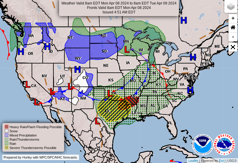
Weather Prediction Center map for April 8th:
Comments