Snow or Not for this Weekend? Tracking the System Across the United States
- Tim Dennis
- Jan 7
- 4 min read
New England's pattern of persistence will continue for most of the rest of this week with highs in the teens north to 20s south and wind chills in the single digits and teens. The winds will continue to crank through Thursday. Another long-duration upslope snow shower event will kick off for the mountains today, bringing several inches of new snow to slopes through Thursday. This all comes as a cutoff low continues to sit to the northeast, maintaining broad cyclonic flow over New England.

This meandering cutoff low will finally begin to drift away from the Canadian Maritimes into Friday. This will support broad cyclonic flow coming to an end for New England, allowing for temperatures to moderate and get a notch warmer than where they have been. This will also allow for a very gradual reduction in the winds as New England gets into brief and weak ridging. This pattern shift also seemingly opens the door for other weather makers to enter the picture after being dominated by the cutoff low.
The main weather maker to watch will be a potential coastal storm moving up the east coast this weekend. There remains a lot of questions surrounding the storm, which is thanks mainly to where the storm is headed. As of Tuesday morning, the main piece of this storm is located over southern California. From there, the low pressure system will enter and traverse the desert southwest, which brings us to our first bout of uncertainty.

Operational models have been flip-flopping all over the place as they try to figure out all the possible solutions at the end of this week. A big reason for this flip-flopping is that models can struggle to figure out what weather systems will do once they enter the desert southwest (the systems basically get lost in the desert). Until these systems emerge from the desert, models will continue to show discrepancies and uncertainties will remain on the high end.
The system is expected to emerge from the desert around the middle of the week. From there, it will likely begin to come together and actually start to resemble a storm system. How quickly the storm is able to organize and strengthen over Texas remains a bit of a question mark (this uncertainty for Texas goes back to the fact that it's lost in the desert). Depending on how quickly it organizes, portions of Texas could see an impactful winter storm, including the Dallas area, by Wednesday night into Thursday night.

Through the end of the work week, the storm will traverse the south, bringing snow and ice to portions of the deep south, including northern Mississippi, Alabama and Georgia. The storm will continue to strengthen and organize over the south. The system will become moisture-rich as it draws in moisture from the warm Gulf of Mexico.
By Friday afternoon or evening, the storm will likely be around the southeast, possibly near northern Florida. With the storm strengthening over Texas and running across the south, there are questions about how much it can maintain its strength as it shifts eastward. Also by Friday, it may begin to show signs of interaction with a northern stream system that will be pushing across the Great Lakes during this time.

From here, uncertainty spikes as significant differences in outcomes remain. The main storm system will push across the southeast and over the Atlantic Ocean. How the storm evolves from there will come down to the levels of interaction (or phasing with the northern stream system. Less phasing would keep the moisture rich southern system to New England's south, resulting in minimal impacts. More phasing would result in a more widespread and impactful storm as the system will be drawn northward and injected with energy.
The overall trends have been in favor of less phasing resulting in a more open wave of low pressure passing to New England's south. Out of the major models, the GFS has been the most adamant that the systems will phase and pass the storm near the benchmark. With that said, overnight trends within this model have shifted southward as well, though it will likely continue to flip-flop, as will other models and no singular model or model run can be taken seriously by itself yet.

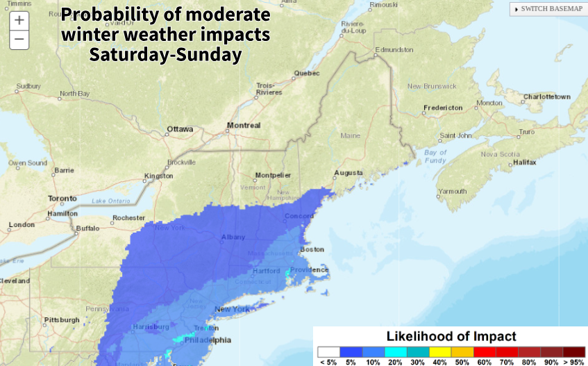
It should be noted that this is not an "all or nothing" scenario. While many remain focused on either a direct hit and major snowstorm or a complete miss, a middle ground is also possible. This would involve some interaction with the northern stream, pulling the system a bit northward, resulting in some snow, mainly across southern New England. There is still a wide range among ensemble members, though more favor a southern track/less phasing outcome. Even with little phasing, the northern stream energy on its own could still bring a round of light snow showers to much of New England.
Below: Current probability of moderate winter weather impacts Saturday morning into Sunday morning:

Another note to mention are ocean temperatures. The waters off New England's south coast are currently below average while waters farther south, near the Carolinas are above average. This difference does favor cyclogenesis of coastal systems. The question is how strong can storms get and how quickly as well as how close they can track to New England. This will be something to watch as we enter the height of nor'easter season (mid-January through about mid-March).
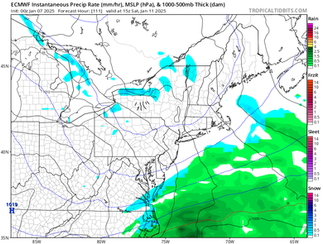
Model roundup (Euro, GFS, CMC & GraphCast) for Saturday afternoon/evening. These will continue to shift around and, as we wrote earlier, none of them can be taken seriously on their own at this point. This is just to show trends:


Comments