After a very busy start to the week for New England's weather, the remainder will be very quiet with mostly seasonable temperatures. Here's the details:
TUESDAY & WEDNESDAY
Today will be a very standard mid-December day across New England. Skies will be partly cloudy to mostly sunny with light winds and seasonable temperatures. Afternoon highs will be in the upper 30s to mid 40s in southern New England and the low 30s to low 40s in northern New England.
On Tuesday night, a cold front will enter into northern New England and make its way through the region overnight into Wednesday morning. This front will likely produce some light snow showers across the northern third of New England overnight to Wednesday morning, but it should remain dry further south.
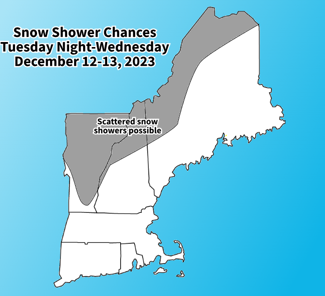
The daylight hours of Wednesday will basically be a repeat of Tuesday with another day of partly cloudy to mostly sunny skies and seasonable temperatures. Some scattered flurries and snow showers will be possible across the higher elevations of northern New England through Wednesday and into Wednesday night.
Later on Wednesday, a northwest flow will kick in at the surface behind the cold front, allowing much colder air to drop into New England. Temperatures will drop off Wednesday night, with lows in the low 20s south and single digits north. It will get a bit gusty once the winds shift, which will add an extra bite to the chill.
THURSDAY
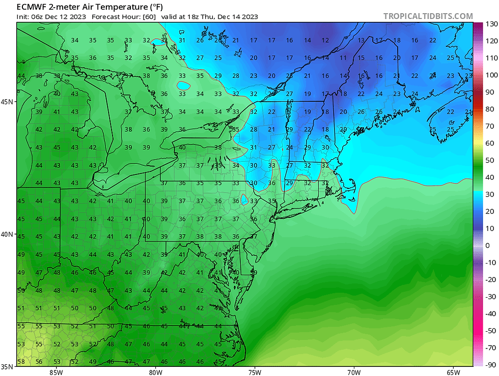
A very expansive area of high pressure begins to build into New England on Thursday. This will lead to continued calm weather with mostly sunny skies. A strong northwest flow will continue, leading to a cold day. Most of New England will not climb above the freezing mark, and the areas that do will not make it past the mid 30s.
Temperatures Thursday afternoon:
FRIDAY-SUNDAY
This week's cooldown will last just one day as a large upper-level ridge builds into New England, bringing mild temperatures aloft. This, along with the expansive area of high pressure at the surface, will introduce warmer air back into New England. Afternoon highs will push to at least 40° for pretty much all of New England during this time with southern New England pushing well into the 40s toward 50°.
A very weak front will push into northern New England Friday night into Saturday. This will mainly produce increased clouds for northern areas Friday afternoon into Saturday. A couple brief, light showers will be possible across the north. Other than that, it will be mostly sunny to partly cloudy and dry during this timeframe.
BEYOND
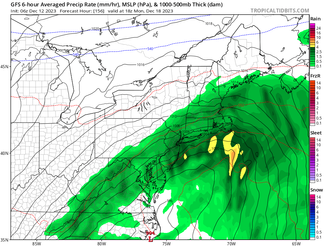
Heading toward the end of the weekend, a coastal storm will likely work up the east coast and arrive in the northeast early next week. With mild air in place, this is looking like another rainstorm for New England, but the trends will need to be watched over the course of the week.
This will have the chance to be a potent storm, but the track (naturally) remains uncertain at this time. The storm could remain too far to the south of New England to bring anything of note to our region. If it does come into New England, it will have the chance to bring another bout of steady rain and gusty winds to at least part of New England.
Here's what the Euro, GFS, CMC and GrahpCast are showing for this storm on Monday afternoon:


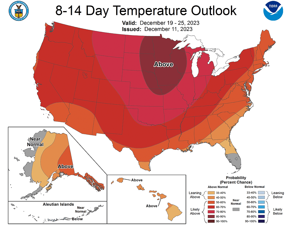
Looking at the big picture heading into next week and beyond, both the NAO and PNA indices are looking to be positive. This will support keeping arctic air mostly locked to the north. This can be seen in the NOAA temperature outlook, showing above average temperatures generally dominating the country. This is all indicative of a strong El-Nino winter.
Comments