New England's week will begin cool and a bit damp before warming up and becoming drier late in the week. And, yes, we're once again watching a storm system for the weekend. Here's the details:
MONDAY & TUESDAY
A cutoff low just offshore of Nova Scotia will very slowly be pulling away during the start of this week. This system will cycle clouds scattered showers through all of New England Monday afternoon through the overnight. Monday will be dry much of the time with small showers popping up throughout the day.
HRRR showing scattered showers moving generally north to south. This will occur throughout the day:
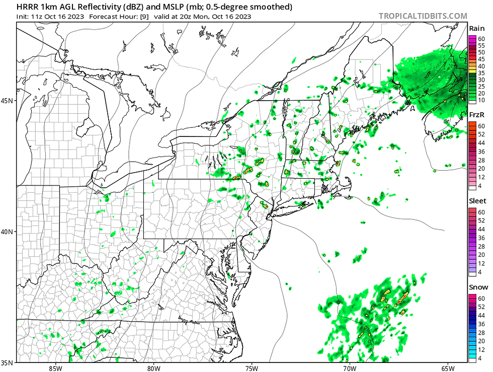
With cold air aloft (the freezing level is down to about 5,000 feet today), some of the showers could mix in some graupel, which are basically small ice pellets similar to sleet. Graupel forms differently than sleet, however. Graupel forms when super-cooled water droplets fall through a layer of cold air aloft, where there are snowflakes. The droplets freeze on the flakes and fall to the ground as small ice chunks.

Tuesday will be similar to Monday, however, the system will be sliding further east. This will lead to another day of mainly cloudy skies (some peaks of sun will be possible Tuesday) with some isolated showers popping up. Shower coverage will be much less Tuesday than Monday. With the system sliding eastward, the highest chance for showers will be across eastern areas.
With cold air aloft, temperatures will run cool at the surface. Highs will be in the 50s across the region both Monday and Tuesday, though northern Maine and northern New Hampshire may not be able to break out of the 40s.
WEDNESDAY-FRIDAY
Wednesday will act as transition day from a trough to a ridge. This will lead to plenty of clouds on Wednesday, but a dry day (pretty much, a spot shower or two can't be ruled out as disturbances aloft move through). Thursday and Friday, New England will be into a ridge, allowing for more sun, along with warmer and drier weather. New England's next disturbance will likely be moving late week, so clouds will likely increase by Friday afternoon or evening.
Temperatures will jump back into the 60s for most during this time frame, with highs near 70 possible in areas across southern New England. Your typical cooler spots in northern New England may top out in the upper 50s.
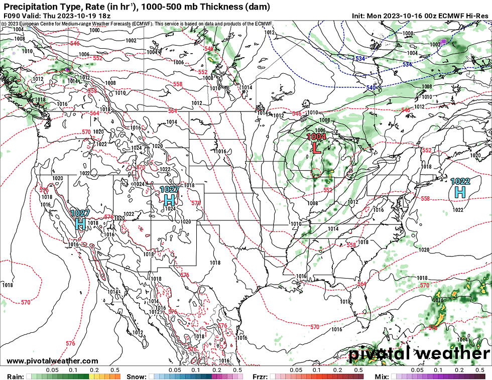
Weather map for Thursday afternoon. New England is dry and warmer under high pressure while the next system hangs over the Great Lakes:
WEEKEND
A system is looking to drop out of Canada and into the middle of the United States mid-week. The system will then slide eastward, likely landing it in New England by Friday night or Saturday. This system could rapidly intensify as it pushes through (or near) New England.
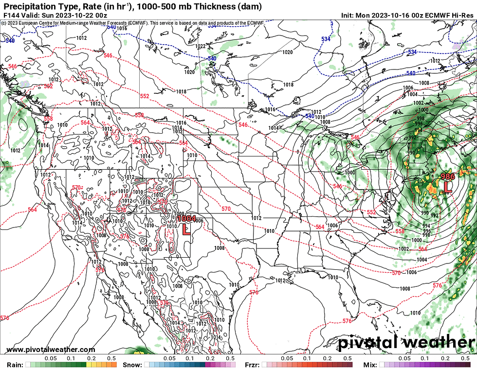
Weather map for Saturday showing a potent low pressure system off New England's coast:
With the current setup, the potential exists for at least an inch of rain in places along with gusty winds. There would also be the possibility of torrential downpours at times. The exact track and intensity will determine the impacts in New England.
We were in a similar situation this past weekend and last Monday (10/9), it was looking like a storm system would bring a widespread rain to New England last weekend (10/14-15) before the system was pushed south, keeping New England mostly dry.
While the setup this time is a bit different, and the chances for unsettled weather are higher for this upcoming weekend, the moral of the story here is nothing is locked in just yet, we'll continue to watch the trends as the week unfolds.
コメント