This week will be just a bit unsettled at times for New England as the week will be dominated by broad cyclonic flow. The week will also feature a cooling trend, with a brief disruption on Wednesday.
MONDAY & TUESDAY
A departing area of low pressure to New England's northeast will keep the region under broad cyclonic flow during this time. This will result in scattered snow showers across the mountains. Some isolated rain showers (or a rain/snow mix) will be possible outside the mountains. Southern New England will likely just see some increased clouds. These light snow/rain showers will gradually become more isolated in the mountains until they just about shut off by Tuesday afternoon.

Both Monday and Tuesday will be somewhat breezy days. This will add a chill to the air, especially after New England's mild stretch. Temperatures aloft are cooling, which will result in a cooling trend through this week. It won't be cold for this time of year, we're just returning back to more seasonable temperatures for mid-March. Highs Monday will generally be in the 40s with some 30s hanging on in the mountains. Tuesday will be a notch cooler.
WEDNESDAY & THURSDAY
Wednesday will likely see a brief disruption in the cooling trend. This comes as a clipper system drops out of Canada toward the Great Lakes. This system will pull a weak warm front into New England, which may briefly change the flow to a more southerly direction, allowing highs to get a notch warmer on Wednesday.
This warm front could touch off a few isolated showers during the day on Wednesday, but the bulk of the precipitation will slide through New England Wednesday evening through the overnight hours and exit eastern Maine by Thursday evening as the system's stronger cold front moves through. Most of New England will see precipitation overnight Wednesday and exit by Thursday morning.

This clipper will be fast moving. The system will also be relatively moisture-starved as New England's atmosphere will be very dry as this system moves into the region. This will result in lighter rain and snow showers for most. The formation of a secondary low in the Gulf of Maine will help to enhance snowfall rates for northern, and especially higher elevation, areas overnight Wednesday.
A few inches of snow will be possible across the Green and White Mountains as well as northern Maine. Just how much snow will fall for these areas will be dependent on how quickly the secondary low can form. Recent similar events have been slower to develop than expected, which has led to lower precipitation amounts. Southern New England as well as southern New Hampshire and southern Vermont will likely only see a few showers.
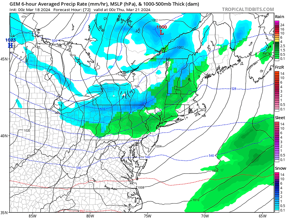
CMC showing snow/rain showers around Wednesday evening. These will generally be lighter and scattered around:
Thursday will be chilly and breezy in the system's wake. High pressure will build to New England's north, keeping a northerly flow and chilly around with highs in the 40s south and 30s north.
FRIDAY
Friday will be a quiet day with high pressure remaining in charge. The day will likely remain breezy, but not quite as breezy as Thursday as pressure gradients begin to relax. Friday morning will likely be the coldest morning of the week with lows running from the teens north to 20s south.
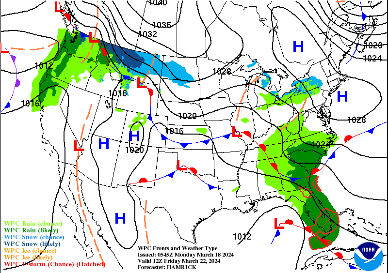
Weather map for Friday:
WEEKEND
This weekend will see a storm system form off the Carolina coast. This system will try to ride up the coast toward New England, but an area of high pressure to the north of New England may make it difficult for the system to reach New England. Depending on where that high sets up, it could keep the storm suppressed to the south.
Some moisture from the trough may be able to break into New England. Again, the placement and strength of the high pressure will be key. The takeaway is that there's a lot of uncertainty around a potential system for New England this upcoming weekend. This uncertainty is pronounced when looking at major models, which are currently showing a very large spread in outcomes.
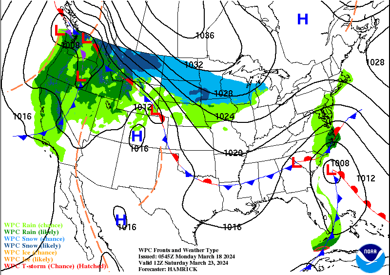
Weather map for Saturday showing the high to New England's north and the low to New England's south:
Comments