This week will be generally nice and seasonable for New England, outside of some spot showers Tuesday and Thursday. This weather could be interrupted by a potential coastal storm this weekend.
TUESDAY-FRIDAY
There won't be much change at all in the overall setup for the rest of this week. Philippe's remnants and a frontal system merged this past weekend. This system is now a cutoff low that is hanging around to our north in Quebec. This system will slowly push eastward throughout the rest of this week. By Friday, the system will likely have moved from north of Lake Huron to north of Nova Scotia.
Satellite showing the cutoff low swirling around the Quebec/Ontario border, with the center of circulation between Moosonee and Timmins:

Anytime a cutoff low hangs around New England, the weather will be very stagnant, with each day similar to the previous one. This week is no exception. Each day this week will feature partly cloudy to mostly cloudy skies, with more clouds the further north you go in New England. Afternoon highs will be seasonable this week, in the 50s north and 60s south.
Some scattered showers will likely move through New England on Tuesday. With dry air in place, any showers will be very light and quick, likely lasting no longer than 10-20 minutes before reverting back to partly cloudy skies.
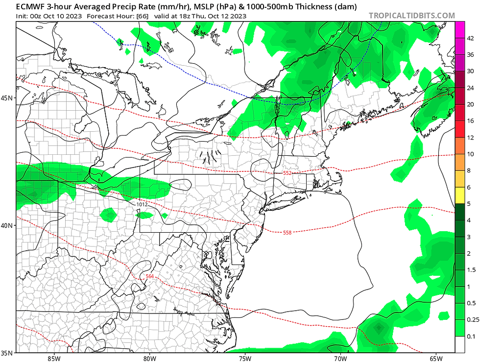
Wednesday into Thursday, the cutoff low will likely be directly north of New England. As this system makes its pass at the region, showers will be possible across the northern tier of New England, with northern New Hampshire and northern Maine seeing the most activity. Northern Vermont is looking to stay dry as the low shifts eastward, away from the state.
Euro model showing where shower activity is most likely on Thursday:
WEEKEND
The weekend's weather will once again be dominated by a storm system. A large area of low pressure will move eastward from the Great Lakes, likely spawning a secondary low along its cold front. This secondary low is currently looking to develop in the Mid-Atlantic region and pass to New England's south. This system could become a rather potent coastal storm.

This will be a rather complex setup, so many details need to be worked out this week, but a coastal storm could be bringing heavy rain, gusty winds and possibly some coastal flooding to southern New England. This storm is currently looking to be a southern New England storm, with impacts tapering off as you head north.
GFS showing the storm impacting southern New England late Saturday into Sunday:
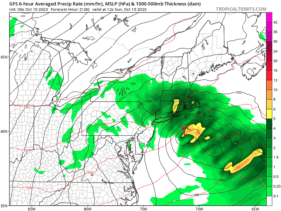
The extent of the impacts listed above (rain, wind, coastal flooding) remains to be seen. This will be determined by the system's track and intensity, both of which remain in the air at this point. The further south the low tracks, the less impacts that will be felt in New England, especially northern New England.
Right now, southern and central New England could see a half inch to an inch of rain, with more possible along the south coast. This is an early indication, and the rainfall forecast will morph as details come into place. As for timing, the system is looking to move through Saturday afternoon through Sunday. Exact timing will be worked out as the weekend gets closer.
Comments