Light Snow, Icing Likely in New England Tuesday Night to Wednesday Night
- Tim Dennis
- Jan 23, 2024
- 4 min read

A weak disturbance to New England's west will bring unsettled conditions to New England over the next 24-36 hours. As this disturbance approaches New England, a warm front will slowly lift through New England. This front will provide the focus for precipitation across New England. While precipitation will be light, the combination of snow and ice has resulted in winter weather advisories being issued. Overall, this will be a low impact, more nuisance-type weather than anything else.

TUESDAY AFTERNOON-WEDNESDAY MORNING
The overall setup across New England will allow for the precipitation to be snow at the start of the event on Tuesday afternoon and evening. Warmer air from the front will slowly work into New England aloft. In the evening and overnight, temperatures will likely remain below freezing from cloud to ground, allowing snow to fall. Some mixing may occur in Connecticut and Rhode Island at the onset of precipitation in the afternoon if it starts soon enough.

For most in New England, precipitation will not begin until well after dark, after temperatures have dropped below freezing. Periods of light, scattered snow showers will continue through the overnight hours into Wednesday morning.
WEDNESDAY AFTERNOON
By Wednesday afternoon, the air aloft will likely have warmed above freezing for much of New England as warm air pours in from the south as the warm front traverses New England. At the surface however, a strong area of high pressure to the north of New England will continue to keep temperatures at the surface cooler. Whenever you have warm air aloft and cold air at the surface, it is a prime setup for mixed precipitation.

Also by the afternoon, a lull in the precipitation is likely for much of New England. There will be lingering showers, both snow and rain (and mixing) possible throughout the daytime hours despite the lull, so it won't be totally dry everywhere the entire afternoon. Overall, Wednesday will be a damp and raw day across New England.
By Wednesday afternoon, light snow accumulations will have occurred across much of New England. With light to steady snow dominating, amounts will be very hard pressed to exceed three inches anywhere. This will be a light, fluffy snow that piles up easily, there just won't be the intensity to pile it up too much.

WEDNESDAY EVENING-OVERNIGHT
Wednesday evening will see the warm air aloft continue to expand. This warmer air (air above freezing) will arrive at the surface in southern and lower elevation areas first, leading to a changeover to plain rain showers. Areas that remain below freezing at the surface will stay with mixed precipitation. Precipitation will generally begin to fill back in during the evening after the afternoon lull.

The warmer air will continue to work northward in New England during the overnight hours from Wednesday to Thursday morning. This will gradually change the mixing to plain rain showers generally from south to north (and from lower elevations to higher elevations).
The mixing area is where the greatest chance for freezing rain will be located during this time frame. As stated before, warmer air aloft will be working into New England while colder air remains at the surface. The depth of the layer of warmer air decides what type of frozen precipitation will fall.

A deeper layer of warmer air will result in freezing rain while a more shallow layer supports sleet. Right now, it looks like the warmer layer will be deeper as the mild air continues to erode the cold air. This would support light freezing rain and drizzle over sleet. Fortunately, as this is not a heavy precipitation event, icing looks to be minimal, with currently low probabilities of anything more than a tenth of an inch. This will still cause very slippery surfaces, but no impact to trees or utility.

THURSDAY MORNING
By Thursday morning, much of New England will likely have switched to plain rain showers minus the eastern slopes of the Green Mountains as well as northern New Hampshire and northern Maine, where continued mixing and freezing rain is possible. Like Wednesday afternoon, Thursday's precipitation will likely be very light and scattered around.

BEYOND
Another disturbance will traverse New England likely Thursday night to Friday as the stalled frontal boundary hangs around. After a couple days of warm air advection into New England, this will be a primarily rain event for New England. Total rainfall amounts from Tuesday through Friday will come in at an inch or less, so, unlike our previous systems, flooding is not a concern.
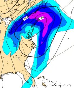
Beyond this unsettled wave, a coastal storm is looking to approach New England late this weekend into early next week. Over the past 24 hours, models have trended this storm closer to New England, but a wide range of track possibilities still exist and the track will play a large role in precipitation. There's not much cold air ahead of the system, so a rain/snow line will likely come into play. Another shot of very cold air could follow this storm on Monday.
What the Euro, GFS, CMC and GraphCast are currently showing for Sunday afternoon and evening. Plenty with this can change:


Comments