Historic Coastal Flooding Causes Major Damage Across Northern New England
- Tim Dennis
- Jan 13, 2024
- 3 min read
The biggest concern coming into this multi-hazard storm was the potential for significant, even historic coastal flooding across Maine and New Hampshire. This comes just three days after another storm caused heavy flooding and damage along the northern New England coastline.
High tide occurred around noon across New England. This was an astronomical high tide. Combine this with an onshore flow from a potent storm causing a surge of three to four feet, and you have a recipe for a major coastal flooding event.
Portland, Maine was forecast to reach a high tide of 14.3 feet today. The preliminary crest at high tide was measured at 14.57 feet. This set the new all-time highest tide in Portland's recorded history (high tide records date back to 1912). This beat the Blizzard of 78's 14.1 feet, which previously held the high- water mark. In Portland, iconic fish shacks at Willard Beach were seen completely washed away.

The entire Maine coastline saw significant water rise resulting in heavy damage. In Tremont, a dock house was washed away. This house was over 100 years old. Chipmans Wharf in Milbridge has been reported to be destroyed. Castine saw a boatyard under 5-10 feet of water, inundating and damaging structures and vehicles. Most piers in Pigeon Hill Bay have been reported to be destroyed.
Propane tanks and dumpsters were seen floating down the streets of Bangor. Roque Bluffs saw people stranded when Johnson Cover Road flooded. The town also saw road and telephone pole damage. Extensive damage has been seen in Scarborough, with roads and homes around Higgins Beach seeing heavy damage. Firefighters in the town were forced to wade through nearly waist deep water to battle a blaze.
Old Orchard Beach saw multiple water rescues and electrical fires as the water inundated multiple structures and roads, trapping residents.
Acadia National Park also saw damage. Ocean Path, a popular hiking trail, has been reported to be destroyed. Route 3 in Bar Harbor was flooded with both water and debris. Southwest Harbor saw large rocks thrown onto Seawall road, making it completely impassable. Wells, Maine saw debris floating down residential streets.
A flash flood warning was issued Saturday morning for the southern Maine and New Hampshire coasts as ocean water continued to rise while bouts of heavy rain poured down.
Scenes of flooding and damage in Maine:
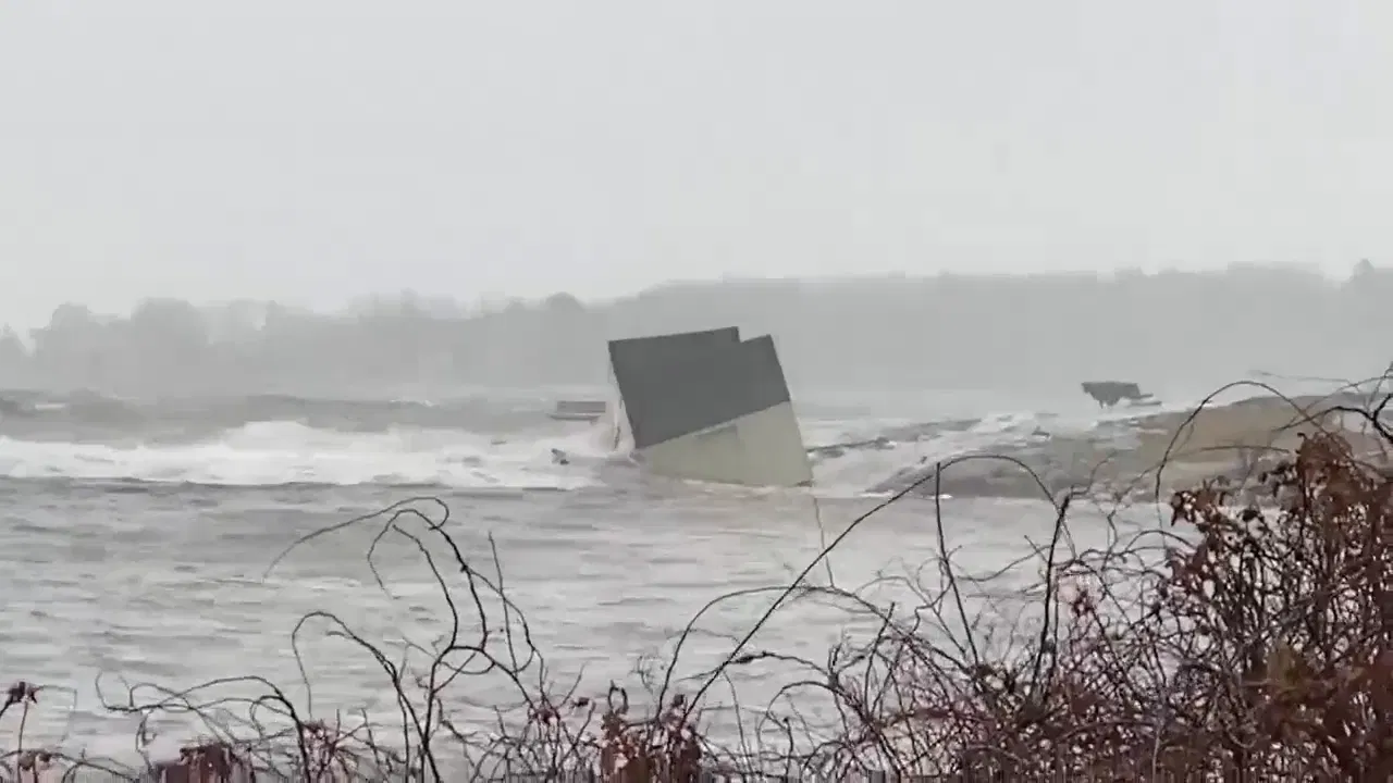

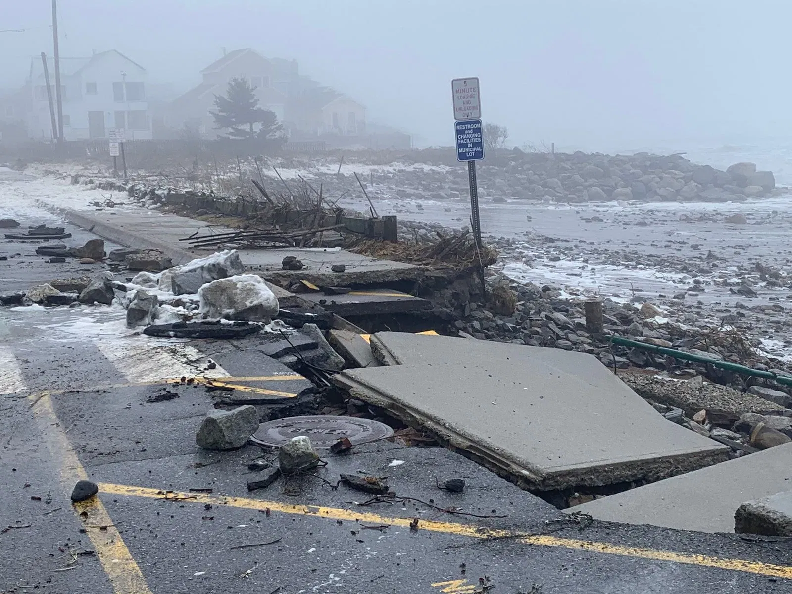


Credits (in order of photos): Michelle Erskine; Scarborough Fire Department; WGME; Norah Hogan; Jen Fullmer; Wells Police; Max Thiele; Benjamin Williamson; Boston and Maine Live
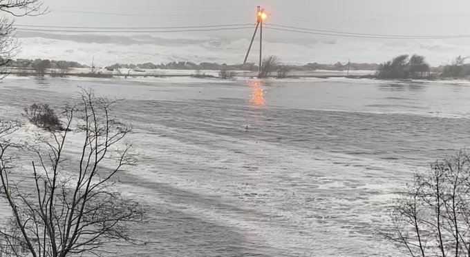
Maine was not the only state that saw major flooding. Hampton, New Hampshire saw the tide crest at 13.76 feet. This was in line with the forecast of 13.7 feet prior to the event. This surpassed the 13.67 feet seen on Wednesday. All roads into and out of Hampton Beach were closed Saturday morning.
A wave was reported to have crashed through the window of a home and began flooding the home. Water rescues were reported across the town with the help of inflatable boats and high water vehicles.
While southern New England did not see coastal flooding to the level of northern New England, pockets of moderate flooding did occur. Narragansett Bay in Rhode Island and in Mystic and Groton, Connecticut also saw moderate flooding. Salisbury Beach in Massachusetts was completely overtaken by the waves.
Scenes of flooding and damage across the rest of the New England coast:


Credits (in order of photos): WMUR; Salisbury Beach Pavilion; Troy Lynch; Troy Lynch; Groton Police Department; Hampton Beach Village District; Summer Sessions
תגובות