A northern stream disturbance will approach New England early Saturday. At the Same time, a moisture-rich southern stream disturbance will begin to work up the coast. The two systems will likely interact, leading to a period of heavy snow in interior northern New England and a soaking rain across southern New England.

Overall, most guidance has generally trended a bit colder with the storm. This has expanded the snowfall farther south, but minimal accumulations are still expected south of the mountains. This also brings in the possibility of more ice. A rain/snow line will lift north during the day. A period of sleet and freezing rain will be possible during the transition.
ALERTS

TIMING
As the northern stream disturbance approaches, it will allow snow showers to break out across much of New England in the early morning hours. Interior southern New England may pick up a quick inch at this time before the changeover to rain. Areas in the foothills and mountains will just begin their snow accumulations.
Expected weather early Saturday morning:

Once the sun rises Saturday, interaction between the northern disturbance and the southern disturbance will begin. This will help inject warmer air into the system, allowing a rain/snow line to gradually work northward during the day. An area of high pressure in Canada will help keep cooler in place in northern New England. This setup will allow a layer of warm air aloft with colder air at the surface across central New England, leading to a wintry mix for a time.
Expected weather around sunrise Saturday (1st image) and Saturday afternoon (2nd image):


By Saturday evening, mixing will likely have reached the foothills while plain rain falls south and heavy snow continues to the north. Soaking rains will likely become more common across southern New England in the afternoon and evening versus the morning. A band of freezing rain may develop across Maine and New Hampshire in a swath extending from about Strafford County, New Hampshire through Washington and southern Aroostook County, Maine.
Expected weather Saturday evening:

Precipitation will generally shut down from west to east Saturday night, with snow ending in eastern Maine by mid-morning Sunday. The storm may briefly end as a mix or snow in areas that saw mainly rain on Saturday.
SNOWFALL
Areas that remain all snow will have the chance to see 1-2 inch an hour snowfall rates. When looking at snowfall rates and our snowfall map below, one might think this is a nor'easter that will rapidly strengthen as it moves inside the benchmark, however, this is not the case. This storm will not undergo bombogenesis. The coastal low pressure will gradually deepen as it moves into the Gulf of Maine.
The heavier snowfall (and rainfall) rates will be supplied by a potential northern stream disturbance that will have added moisture injected into it by a moisture-rich system lifting out of the Gulf of Mexico. With that said, this isn't a completely traditional set up bringing this storm.

What is traditional about this storm is that the heaviest amounts will be across the mountains. The northern Green Mountains, White Mountains and Maine Mountains will all have the best shot at seeing over a foot of snow. While valleys will see less snow than the mountains, this storm isn't as elevation dependent as spring storms typically are.
Snowfall amounts will gradually drop off as you head south and toward the coast as the transition to a mix and rain will occur from south to north. More notable accumulations will generally be from Lake Winnipesaukee northward. Southern New Hampshire, southern Vermont, coastal Maine and northern Massachusetts will likely see a general 1 to 4 inches of snow before the changeover happens.
Bust potential from this storm will come from the storm's overall set up and mixing issues. The level of interaction between the northern and southern streams will be key to both snowfall rates and how far north the mixing/rain gets. It's possible that the two systems interact ahead of schedule, which would lead to a warmer storm. Some high resolution models are showing the rain/snow line making it well into the White Mountains. If this warmer solution occurs, snowfall amounts will be lessened due to mixing.
HRRR (high-res model) showing mixing and rain pushing into the White Mountains:

With that said, our snowfall map does take this into consideration. Some guidance is painting a larger swath of 12-18 inches than our map, but with the uncertainties surrounding mixing and rain, we dialed our foot plus zone back.
RAINFALL
A widespread, soaking rain is on tap for southern and central New England after a brief wave of snow and maybe some ice. The moisture-rich southern stream will allow for heavy rainfall rates, particularly in the afternoon and evening. This will lead to a widespread 1-3 inches of rain. There's a decent shot at locally higher amounts in Connecticut and Rhode Island.

Both poor drainage flooding and some river flooding is possible. Flooding issues are still expected to be more on the minor/more nuisance side. Scattered river flooding is possible across southern New England, with the typical problem rivers likely to exceed their banks. For example, the Pawtuxet and Wood Rivers in Rhode Island currently have an 80-85% chance of reaching minor flood stage with moderate probabilities of reaching moderate flood stage.

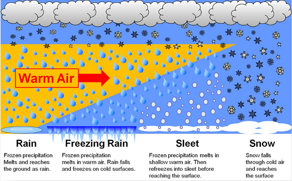
MIXING/ICE
As the rain/snow line advances north, a period of sleet and freezing rain will be possible. As mentioned in the timing section of this article, warm air will likely erode away colder air aloft while colder air remains at the surface. This is always a prime setup for mixing. Some areas could see a prolonged period of sleet/freezing rain mixing with snow/rain. As always, the depth of the warm layer of air aloft will determine whether this is sleet or freezing rain.
As of now, it is more likely for sleet to mix in farther north with freezing rain farther south. A deeper layer of warm air aloft supports freezing rain while a more shallow layer supports sleet. The big question for the areas in the foothills and mountains will be how far that warm layer of air gets to you. If the warm layer makes it to the mountains, sleet would mix in with snow, bringing down accumulations.
In the timing section, we also mentioned the possibility of a band of freezing rain setting up across portions of New Hampshire and Maine. Some areas will have a chance to up to a quarter of an inch of ice accretion by Sunday morning. Overall, icing is not much of a concern, but may result in surprisingly slippery surfaces both Saturday morning and Saturday evening.

Commenti