Extreme Rainfall Leads to Severe Flooding in Vermont's Northeast Kingdom
- Tim Dennis
- Jul 30, 2024
- 3 min read
This is a developing situation. Updates may be added to this article.
The cutoff low pressure system that made its north through New England Monday night into Tuesday morning. This combined with a very moisture-rich atmosphere and the slow moving nature of the system led to intense showers and storms surviving well into the overnight hours. Storm training, when multiple storms move over the same area, set up across northeast Vermont. This led to a rather extreme amount of rain to fall in a very short period of time. We'll go into more detail on the setup of this storm in a later post.
All of this led to upwards of eight inches of rain falling in the span of less than six hours. In addition, some areas of the Northeast Kingdom saw an estimated 3-5 inches of rain in just 3-4 hours. This intense rainfall occurred in a compact area with several communities getting hit the hardest.
A rare flash flood emergency was issued for Morgan Center, St. Johnsbury and Danville, Vermont. Communities surrounding these ones were also hit hard. In St. Johnsbury, 4.38 inches of rain fell in just three hours with nearly half a foot falling over the course of three hours.
Estimated three hour (1st image) and six hour (2nd image) rainfall totals from last night:
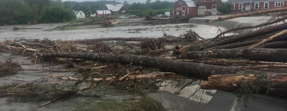
This has brought about a sudden and severe flooding event. Lyndonville, which was one of the hardest hit towns in the severe flooding event that took place earlier this July, has seen major damage once again. Several homes have been reported to be destroyed near Calendar Brook and Red Village Road.
Swift water rescues and evacuations have been reported in Lyndonville and nearby communities. Vermont Emergency Management reported 10 swift Water Rescue teams have performed about two dozen rescues in the Northeast Kingdom. A shelter in place order was put into effect for Lyndon and St. Johnsbury.
In nearby East Burke, severe flooding was reported to have washed out Vermont Route 114. Multiple cars were reported to be underwater in the town. Road washout reports have just started to filter in as of 9am, with several Vermont routes (including, but not limited to, Vermont 114, 111 and 105 and US routes 2 and 5) washed out and closed. The number of damaged and closed roads will rise through the morning hours.
Scenes of flooding and damage from around the Northeast Kingdom:
Photo credits: Lyndon Rescue; Marissa Gadapee; St. Johnsbury Police Department; WCAX
Rivers responded rapidly to all this rain. The Passumpsic River saw an over 1,000% increase in flow in just six hours. The river crested in moderate flood stage and is now receding. Propane tanks and other debris have been seen floating through the river.

Flash flood warnings, along with the flash flood emergencies remain in effect through late this morning. Areal flood warnings remain in place through early this afternoon. Both flash flood and areal flood warnings could be extended depending on how the current situation plays out. Rain has stopped, but flooding will be ongoing for several hours.

This afternoon, enough energy from the departing trough will be present to spark scattered thunderstorms across northern New England. Southern New England will see much more isolated activity today. The greatest chance for storms will be 1pm-8pm. After the overnight flooding rains in portions of Vermont, where downpours set up today will need to be watched closely.


Comments