After a quiet, albeit breezy Easter weekend, attention will turn to the potential for another long-duration precipitation event for New England. The overall setup for this storm will be much different than the system that moved through this past week. This storm will involve an area of low pressure moving toward New England from the Great Lakes.
As this system (a northern stream energy piece) moves northeast toward New England, interaction with the southern stream will help spawn a secondary low somewhere south of New England. This low will strengthen and become the primary low. This system will likely slowly crawl along in the vicinity of the Gulf of Maine, leading to a prolonged event.
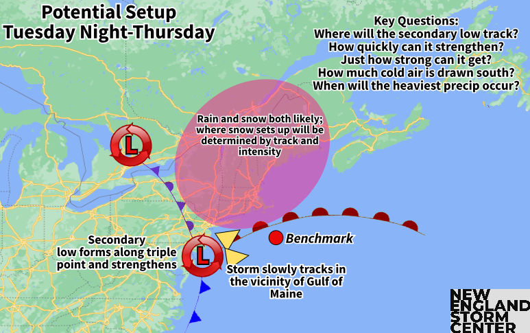
Models have come into agreement on this setup. What they (expectedly at this stage) don't agree on is exactly where the secondary low will track and just how strong it will get. Both of these factors will play a large role in exactly what occurs, along with the ever important question: how much?
The general timing of this system has precipitation occurring from Tuesday through Thursday. The following timing is based on current trends and will likely be tweaked as this event draws closer. It is not locked in yet. The precipitation may start out as rain for most of New England Tuesday and Tuesday night as the primary low slowly lifts northeast.
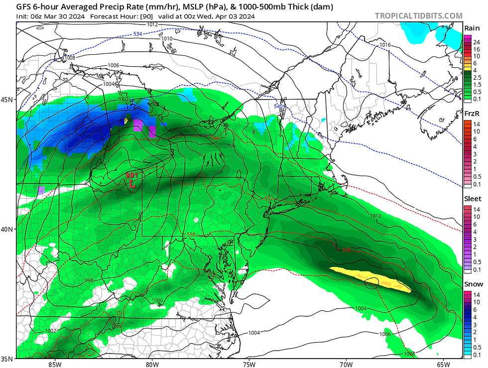
GFS current solution for Tuesday evening. Remember this is just one model and absolutely not locked in:
The secondary low will likely begin to form sometime in the second half of the day Wednesday. The formation of the secondary low will help aid in transitioning the rain to snow across New England. This transition would occur from north to south and higher elevations to lower elevations during the day Wednesday into Wednesday night. The exact timing of this switch, and the extent of the switch to snow is impossible to try to go into right now.
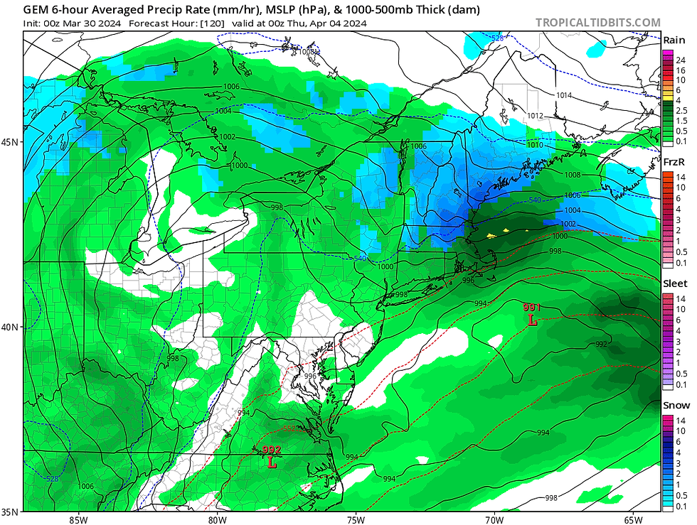
CMC current solution for Wednesday evening. Remember this is just one model and absolutely not locked in:
Rain and/or snow showers will likely linger for much of the day Thursday before finally beginning to shut off by Friday. That is the basic trend on timing and this will very likely be tweaked as next week approaches, especially the latter half of the timing (Wednesday afternoon through Friday).
As always, the million dollar question is how much? How much snow? How much rain? Where will it all fall? These questions simply can't be answered yet. Being early April, it's safe to assume at this point that elevation will play a large role in snowfall with higher elevations seeing much more than lower elevations.
At this point in the season, to get more notable accumulations, the snow really needs to fall overnight (unless the storm becomes powerful enough to create intense snowfall rates that can overcome the ever-strengthening sun angle). With that said, the timing of the heaviest precipitation will play a large role in potential snowfall amounts.
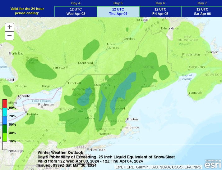
Weather Prediction Center probability of impactful winter weather Wednesday morning through Thursday morning, showing probabilities up to 50% for the higher elevations of northern New England and the Berkshires:
As with any spring storm, snowfall amounts will be tricky to pin down. This is because temperatures will be marginal, leading to a wet, heavy snow. This snow compresses as it falls and is difficult to pile up in large quantities. Models can have trouble determining snowfall amounts anytime of year, but especially in the springtime, when snow-liquid ratios (SLRs) will likely be low.
SLRs basically determine how much water is being held within the snow. The wet, sticky snow has more water content, leading to a lower ratio. Most models predict straight snowfall by assuming a 10:1 SLR. This means that for every 10 inches of snow, there would be one inch of water within the snow. In these spring storms, the ratio will likely be lower in many areas, leading to lower accumulations than what is being produced by models using a 10:1 ratio.
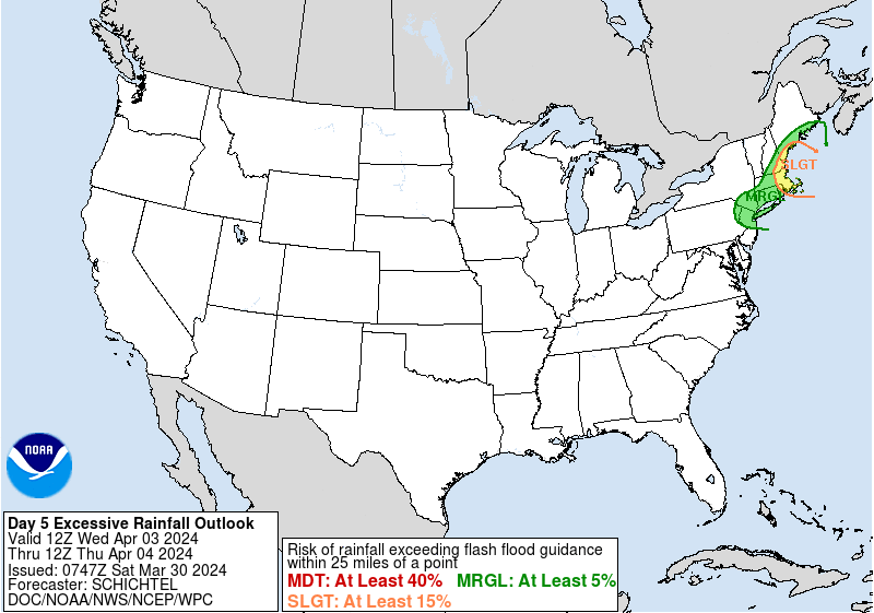
One last piece to go into right now is the fact that there will be a chance for a decent soaking of rain in areas that stay rain much of the time. The Weather Prediction Center has portions of eastern New England in the "slight" category (level 2 of 4) for excessive rainfall in their day 5 outlook.
WPC excessive rainfall outlook for Wednesday morning through Thursday morning:
Comments