Temperatures will be soaring by late-October standards for much of New England to close out this week. A strong area of high pressure will park to the south of New England. This high will be expansive, with much of the eastern United States feeling its presence. In New England, this high will help transport warmer air from the south into the region, as well as keep rainfall away (for the most part).
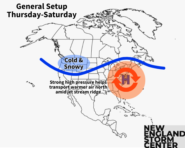
The high will begin to build on Wednesday, with temperatures climbing into the upper 60s to low 70s across most of New England. A cold front to the north will stall near the Canadian border, which may bring some showers to the northern third of New England Wednesday through Friday. Whether or not showers occur, there will be more clouds toward the Canadian border for the rest of this week, which will limit temperatures in these areas.
For central and southern New England, there won't be too much holding the temperatures back. The main issue with warming is, naturally, the time of year. The ever-weakening sun angle of the fall makes it more and more difficult to warm the surface layer to its full potential in set ups like this (if it was July, we'd be talking quite a heat wave).
Temperatures Thursday and Friday will be very similar to each other, with highs safely making it into the 70s for southern and central areas, with mid to upper 60s in the northern third of the region. Some cities could near daily record highs Thursday through Saturday.
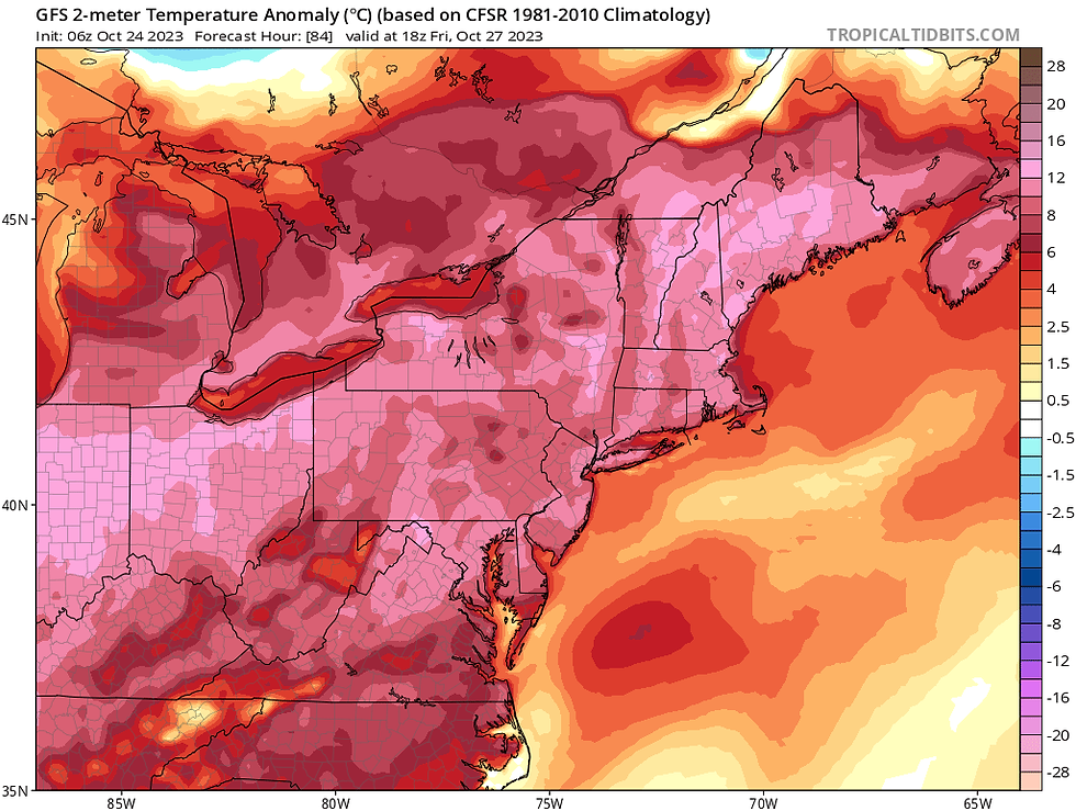
Temperature departure from average map, showing highs 10-15° above average for much of New England on Friday:
In our forecast post for the week published yesterday, we mentioned that Saturday could end up being the peak of the warmth, depending on the timing of a cold front. It's now looking increasingly likely that this heat will, indeed, peak on Saturday as the cold front stays north and west of New England. Temperatures will likely shoot well into the 70s once again for southern New England and central with 60s remaining in place for northern areas.
It's not completely outside the realm of possibility for the typical warm spots of southern New England to touch the 80° mark. The areas most likely to have a chance at this would be the Connecticut and Merrimack River Valleys. It is very unlikely anywhere makes it to this mark, but it's at least worth mentioning, with highs currently forecast in the upper 70s in these warm spots.
Temperature forecast for Saturday at 2pm, showing a lot of mid to upper 70s:

For those who want late October to feel like the middle of fall, here's the good news. That cold front mentioned earlier will be dropping into New England eventually. Right now, Sunday is looking to come back down closer to average, with the cool down very likely continuing into next week.
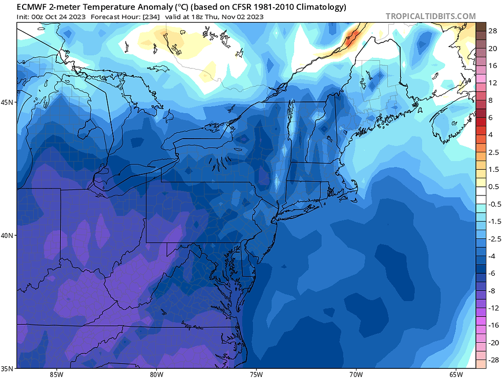
We're still on track for below average temperatures to kick off November, with some real fall chill. An outbreak of arctic air is currently over the plains in the western United States, where the first expansive snowstorm of the year is currently unfolding. This colder air will likely push into the east by next week, although it will moderate, meaning it won't be as cold here next week as it is currently in the west.
Temperature departure from average map for November 2, showing a lot more blue:
Comments