2025 Boston Marathon Weather Outlook
- Tim Dennis
- 2 days ago
- 3 min read
The final countdown to the 2025 Boston Marathon is here and the weather for the race is coming into view. This year's race is currently looking pretty quiet in the weather department as of now, but there's one system to keep an eye on in regards to timing and potential shower activity.

Heading into marathon weekend, a frontal system will cross New England on Saturday. This system is poised to lift its warm front through the region, bringing quite a warm-up and some showers for Saturday. Temperatures are currently positioned to reach well into the 70s, potentially toward 80° on Saturday.
This system will drag its cold front across the region for Easter Sunday, cooling things back off by race day. Overall, signals are pointing to seasonable temperatures on Monday with morning lows in the low 40s and an afternoon high in the upper 50s or low 60s. There is the potential for a crisp start to the day.
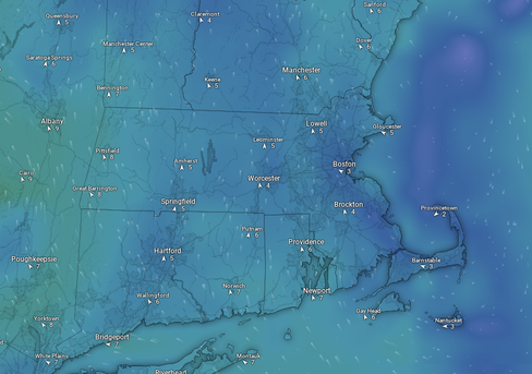
Below: AIFS showing potential temperature departure from average for Monday afternoon:

As far as precipitation goes, it currently looks like the needle will be threaded between Saturday's frontal system and an incoming system early next week. Monday is currently trending mainly dry right now. There is another frontal system currently poised to move through New England early next week. As of now, the highest chance for potential showers from this system looks to enter the region later in the day Monday through Tuesday morning. High pressure will likely be moving offshore, which will likely keep drier air over eastern Massachusetts and potentially delay precipitation onset time.
Below: Current weather map for Monday morning, with the frontal system over the Great Lakes:

With that said, the timing of the high pressure moving offshore and the incoming frontal system will need to be monitored over the coming days. While ensemble guidance generally has showers enter the picture Monday night to Tuesday morning, an earlier shift is certainly possible at this time range.
It should be noted that this system doesn't look very moisture-rich anyway, so it will likely be more in the way of scattered, lighter showers rather than a period of rain. Again, this is currently poised to enter the region later Monday and Tuesday, but the trends will be watched in regards to timing.
Below: Current precipitation forecast for Monday morning through Tuesday morning, showing very minimal rainfall of 0.01":

There will likely be a surge of humidity (relative to mid-April with dew points climbing well into the 50s) with the warm front on Saturday. The trailing cold front for Sunday should wipe this away, with dew points returning to drier levels. With that said, should the frontal system enter the picture earlier, it would allow for dew points to climb a bit higher.
With high pressure just offshore, winds are trending to be on the lighter side. As of now, winds are looking to be out of the south. The Euro has a lighter wind that's more due south while the GFS (and its earlier arrival of the system) has winds more southwest and a bit stronger. Overall, lighter winds will allow for variable directions and a more easterly component could develop when getting into Boston due to a potential sea breeze.
Below: Current wind projections from the Euro (1st image) and GFS (2nd image). Note that these are just current trends, don't take it literally yet as winds can be highly variable:


Diving into the big picture, the United States will be moving away from a ridge-in-the-west-trough-in-the-east setup. This will be trending toward a more zonal flow entering into next week (which is when the jet stream lays flatter across the US without pronounced ridges or troughs). Zonal flow lends itself to generally seasonable temperatures and weak, moisture-starved weather systems that are quick moving.
Timing out the weather systems does become more difficult in zonal flow since the systems tend to move quickly. This is why the system moving through later Monday into Tuesday will need to be monitored, if only for the potential of scattered, light showers.
MARATHON WEATHER HISTORY
It's been 58 years since runners last battled snow during the marathon in 1967. Being in the middle of spring, the threat for rainy marathons is much more common. The hottest marathon saw a high top the 100° mark in 1905. Highs have reached at least 80° on several occasions, most recently in 2012.
The 1905 and 1906 marathons are a perfect example of the wide range of conditions possible during the marathon in the middle of spring. The 1905 marathon reached the century mark with temperatures while just a year later, snow was recorded for the first time during the race.
Comments